
Trip Report: Mt. Ellinor- Lower Trailhead. Olympic National Forest, WA
When: 6/30/2019
Location: Mt. Ellinor
Conditions: The conditions for this hike were wonderful. It was a high of around 70, light breeze, and there was periodic cloud cover which helped with some of the shade at the top of the hike. The trail was in great condition. It appears to be a decently trafficked area, but I was surprised at how clean the trail itself was.
Duration: The hike took my party around 7 hours, car to car. The round trip mileage is approximately 6.2 miles with 3300 ft elevation gain. We started around 8:40 am and were back at the car around 3:30 pm. We spent around an hour at the summit enjoying snacks and the view, and the company of a bunch of mountain goats and other hikers.
Kid FriendlyYes, we did see families with children on the trail. I would not take inexperienced hikers on this trail, though.
Pet FriendlyYes, absolutely
Difficulty: I would consider this is be a moderately difficult/ strenuous hike. The hike from the lower trailhead is 6.2 miles round trip, with a 3300 ft elevation gain. Most of the elevation gain starts at Mile 2, where the upper and lower trails meet to head toward the summit. The start of the lower trailhead cruises through a nice wooded area then climbs steeply through some thinning out forest around mile 2. The trail turns into a nice little scramble towards the top of the climb before you reach the summit. The trail is relatively easy to read, and there is a fair amount of signage and other hikers, so one would have a decent time with navigation and staying on the trail.
Usefull links: www.wta.org
 Full Report:
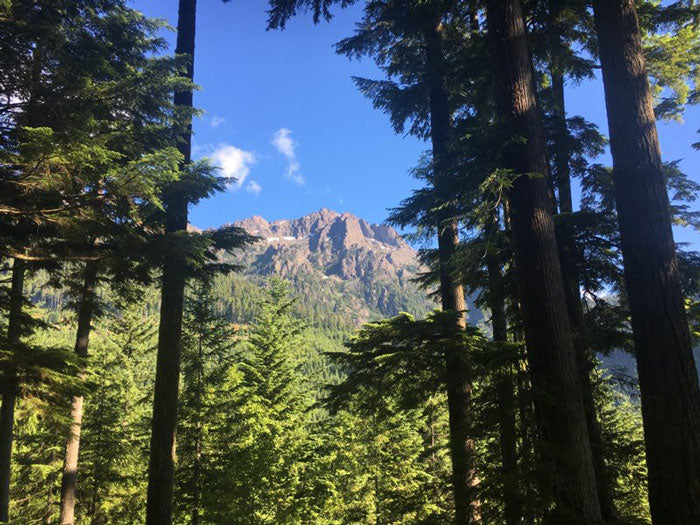
This hike was completed on Sunday, June 30th, 2019. We got to the trailhead parking area around 8:30 am. To get to the trailhead, we drove down a dirt road 7 miles. The road was pretty rutted out, so low clearance vehicles be warned! The hike started off with a relatively mild climb for the first two miles before the lower and upper trailheads met to climb the summit. There are a number of viewpoints where you can stop to see views of the top of Mt. Ellinor.
Full Report:
This hike was completed on Sunday, June 30th, 2019. We got to the trailhead parking area around 8:30 am. To get to the trailhead, we drove down a dirt road 7 miles. The road was pretty rutted out, so low clearance vehicles be warned! The hike started off with a relatively mild climb for the first two miles before the lower and upper trailheads met to climb the summit. There are a number of viewpoints where you can stop to see views of the top of Mt. Ellinor.
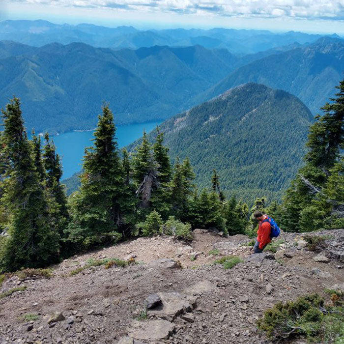 The beginning part of the trail is completely wooded and beautiful. It was a great way to warm up the legs. For the majority of the 3300 ft elevation gain, expect it to happen after reaching mile 2. From there, there are a decent number of switchbacks that carry you towards the summit, but towards the top of the climb some of the area turns into a scramble, and you can decide which routes may be easiest for one to maneuver. There are a few more viewpoints you can stop at that will reward one with sweeping views of Lake Cushman and the surrounding mountains and valleys of the Olympic Peninsula.
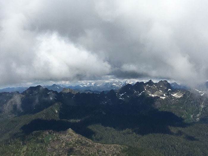
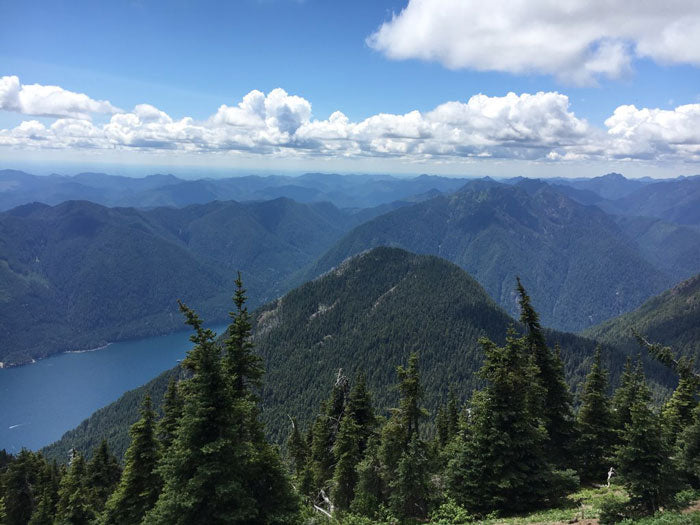 The summit provides one with amazing views of most of the mountains in the Olympic range. Mt. Ellinor is located in the Southeast section of the Olympic Nation Forest, so it's neat to look north and see other summits. It provides one with inspiration to continue on. At the summit, we were greeted by dozens of other hikers and some mountain goats. We spent around an hour hanging out and taking in the views. There were some clouds that rolled in, so we didn't get to see everything from the summit, but it was enough to get the concept. We even got to see the clouds break enough that we got a slight view of Mt. Rainier! On a clear day, one can see some of the Cascade volcanoes from this summit.
 Overall, anyone can complete this hike, but it definitely rests more on the strenuous side of ratings.
Full Report:
This hike was completed on Sunday, June 30th, 2019. We got to the trailhead parking area around 8:30 am. To get to the trailhead, we drove down a dirt road 7 miles. The road was pretty rutted out, so low clearance vehicles be warned! The hike started off with a relatively mild climb for the first two miles before the lower and upper trailheads met to climb the summit. There are a number of viewpoints where you can stop to see views of the top of Mt. Ellinor.
The beginning part of the trail is completely wooded and beautiful. It was a great way to warm up the legs. For the majority of the 3300 ft elevation gain, expect it to happen after reaching mile 2. From there, there are a decent number of switchbacks that carry you towards the summit, but towards the top of the climb some of the area turns into a scramble, and you can decide which routes may be easiest for one to maneuver. There are a few more viewpoints you can stop at that will reward one with sweeping views of Lake Cushman and the surrounding mountains and valleys of the Olympic Peninsula.
The summit provides one with amazing views of most of the mountains in the Olympic range. Mt. Ellinor is located in the Southeast section of the Olympic Nation Forest, so it's neat to look north and see other summits. It provides one with inspiration to continue on. At the summit, we were greeted by dozens of other hikers and some mountain goats. We spent around an hour hanging out and taking in the views. There were some clouds that rolled in, so we didn't get to see everything from the summit, but it was enough to get the concept. We even got to see the clouds break enough that we got a slight view of Mt. Rainier! On a clear day, one can see some of the Cascade volcanoes from this summit.
Overall, anyone can complete this hike, but it definitely rests more on the strenuous side of ratings.