Trip Report: King Mountain Trail, Tillamook National Forest
When: 12/09/2017
Location: King Mountain Trail, Tillamook National Forest
Conditions: Cool, wet, and poor visibility. Mostly foggy with rain at the summit of King Mountain.
Duration: 2.55 miles one way (5.1 miles total). This trail took me 2.3 hours to hike up and back.
Difficulty: Very difficult.
Kid Friendly: No
Pet Friendly: Possibly depending on your pets fitness.
Usefull links:
www.alltrails.com
www.oregonhikers.org
The Full Report:
Looking to mix it up a bit (variety is the spice of life I suppose!), I set out for King's Mountain trail in the Tillamook National Forest. I've recently been doing the majority of my hiking in the Gorge on the Washington side, but decided that Tillamook National Forest would be a great natural area to explore as other hikes I had taken in Tillamook (Cape Lookout for example) had yielded beautiful and crisp views of the coast. I was also inspired to do this hike because I had seen a friend on Instagram with a picture at the summit and I was experiencing extreme FOMO (fear of missing out), let the record show.
 As a side note: this hike took me 2.3 hours in total to complete, but make sure to plan out 3-4 hours as a suggested hiking time. I was hiking myself and trying to push on as fast as possible to beat traffic on the way back because I had started a bit later in the day.
I set out on my own, a bit later than usual, at 10am from my home in Clackamas to King's Mountain. The drive was an hour and fifteen minutes and traffic was minimal so I quite enjoyed the scenic views of Tillamook National Forest on the way to the hike. I arrived bundled up in more layers than you could count as the temperature was hovering around 40 degrees, but quickly shed all but my base layer and hiking pants as the trail quickly gained steepness within the first few minutes of the hike.
As a side note: this hike took me 2.3 hours in total to complete, but make sure to plan out 3-4 hours as a suggested hiking time. I was hiking myself and trying to push on as fast as possible to beat traffic on the way back because I had started a bit later in the day.
I set out on my own, a bit later than usual, at 10am from my home in Clackamas to King's Mountain. The drive was an hour and fifteen minutes and traffic was minimal so I quite enjoyed the scenic views of Tillamook National Forest on the way to the hike. I arrived bundled up in more layers than you could count as the temperature was hovering around 40 degrees, but quickly shed all but my base layer and hiking pants as the trail quickly gained steepness within the first few minutes of the hike.
 After about a tenth of a mile, there is a trail sign that lists which trails are ahead and distance to the summit. Make sure to continue going straight towards King's Mountain. If you're looking to extend your hike a bit, after King's Mountain summit, you can link up with Elk's trail which is a 7-mile total trail (up and down). When researching this hike, it had been described as "very difficult," which I shrugged off with a naïve ignorance, but quickly learned that the incline of the trail would only get more extreme as I continued on. This hike is a definite fitness gut check.
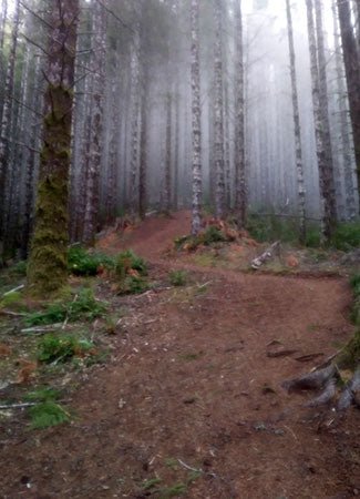
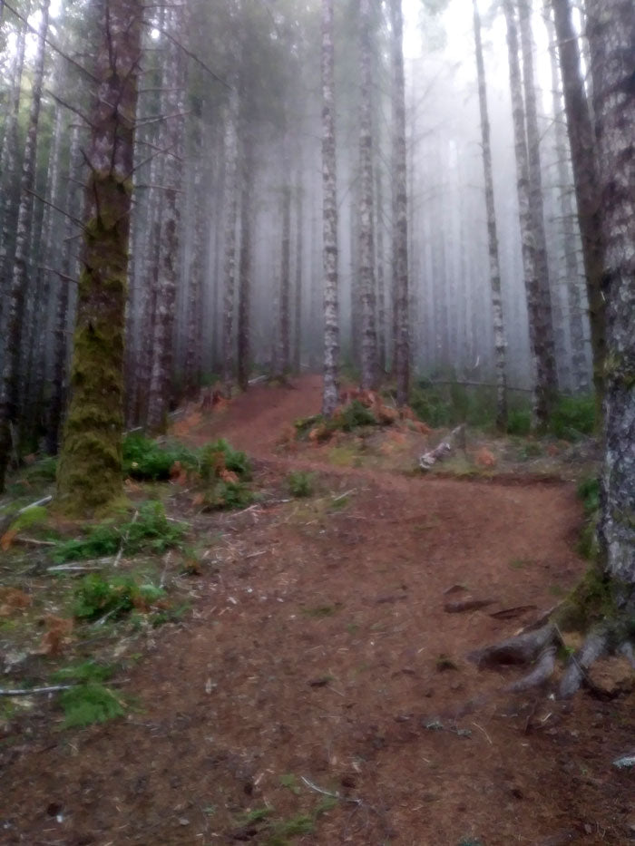
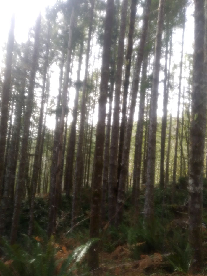
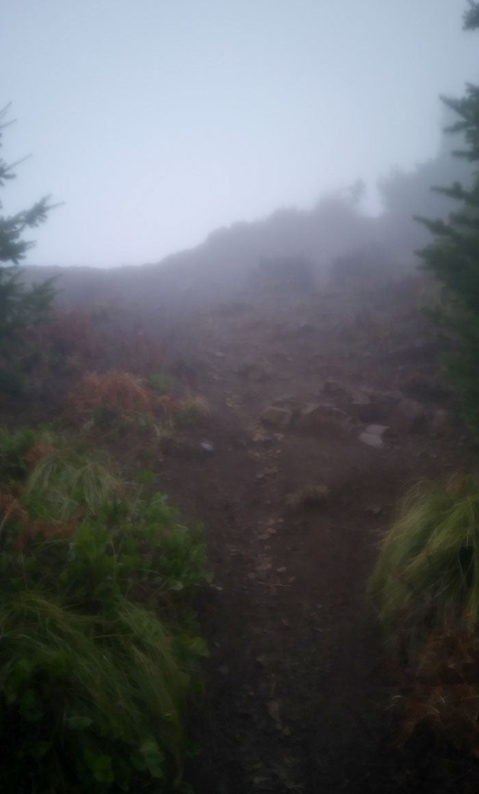
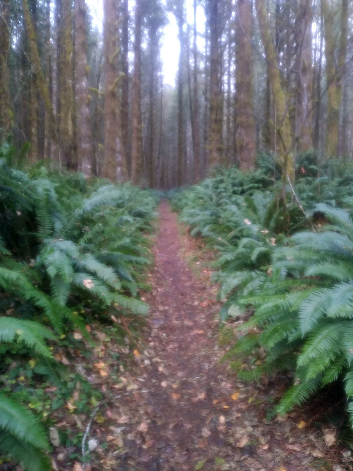 The trail itself was surrounded by lanes of verdant ferns and majestic alder trees while the air was fresh, briny, and aromatic. Because of the foggy conditions and poor visibility this time of year, even as I began to gain elevation and breach the tree line, any sky that was visible was white, like a hiking purgatory of sorts. Despite this, because the trail has been adopted by the Mazamas, it’s well-maintained and easy to navigate even in the poorest of conditions. There were some flat sections of trail to take refuge from the incredibly steep terrain and I periodically took rests and made sure to hydrate and maintain my blood sugar with a banana or energy bar as I went to keep up with the demand of the trail.
 Eventually, after what had felt like endless hills, I reached a picnic table near the first viewpoint before the summit. Again, visibility was poor, but the fact that I was now at eye level with the treetops encouraged me to push on to the summit. Shortly after I encountered some hand over hand climbing on the trail for a brief section and right as my heart felt like it was going to explode from the intense cardio hill workout, I was overtaken by the summit and how wonderfully silent and peaceful King's Mountain Peak was. On a clear day you can enjoy views of Mt. Hood and Mt. Adams, but no matter what the conditions or visibility, this hike is worth it for the feeling of achievement once you hit the summit.
I walked up to the King's Mountain Summit sign which read "King's Mountain Summit, 3,124 feet." I was shocked as I realized that I had hiked 2500 feet up in elevation! There was a light sprinkle of rain at this point, so I slipped on my rain jacket to stay dry and sat and soaked in the summit. After a few minutes of bliss, I headed back down the steep labyrinth of trail, very carefully I might add, as the downhill was just as steep descending as ascending. As I passed other fellow hikers striving for the summit, I made sure to encourage and chant the classic line, "you're almost there!" By the time I reached the parking lot, my legs ached, and I was ready for a relaxing ride back.
Eventually, after what had felt like endless hills, I reached a picnic table near the first viewpoint before the summit. Again, visibility was poor, but the fact that I was now at eye level with the treetops encouraged me to push on to the summit. Shortly after I encountered some hand over hand climbing on the trail for a brief section and right as my heart felt like it was going to explode from the intense cardio hill workout, I was overtaken by the summit and how wonderfully silent and peaceful King's Mountain Peak was. On a clear day you can enjoy views of Mt. Hood and Mt. Adams, but no matter what the conditions or visibility, this hike is worth it for the feeling of achievement once you hit the summit.
I walked up to the King's Mountain Summit sign which read "King's Mountain Summit, 3,124 feet." I was shocked as I realized that I had hiked 2500 feet up in elevation! There was a light sprinkle of rain at this point, so I slipped on my rain jacket to stay dry and sat and soaked in the summit. After a few minutes of bliss, I headed back down the steep labyrinth of trail, very carefully I might add, as the downhill was just as steep descending as ascending. As I passed other fellow hikers striving for the summit, I made sure to encourage and chant the classic line, "you're almost there!" By the time I reached the parking lot, my legs ached, and I was ready for a relaxing ride back.
As a side note: this hike took me 2.3 hours in total to complete, but make sure to plan out 3-4 hours as a suggested hiking time. I was hiking myself and trying to push on as fast as possible to beat traffic on the way back because I had started a bit later in the day.
I set out on my own, a bit later than usual, at 10am from my home in Clackamas to King's Mountain. The drive was an hour and fifteen minutes and traffic was minimal so I quite enjoyed the scenic views of Tillamook National Forest on the way to the hike. I arrived bundled up in more layers than you could count as the temperature was hovering around 40 degrees, but quickly shed all but my base layer and hiking pants as the trail quickly gained steepness within the first few minutes of the hike.
After about a tenth of a mile, there is a trail sign that lists which trails are ahead and distance to the summit. Make sure to continue going straight towards King's Mountain. If you're looking to extend your hike a bit, after King's Mountain summit, you can link up with Elk's trail which is a 7-mile total trail (up and down). When researching this hike, it had been described as "very difficult," which I shrugged off with a naïve ignorance, but quickly learned that the incline of the trail would only get more extreme as I continued on. This hike is a definite fitness gut check.
The trail itself was surrounded by lanes of verdant ferns and majestic alder trees while the air was fresh, briny, and aromatic. Because of the foggy conditions and poor visibility this time of year, even as I began to gain elevation and breach the tree line, any sky that was visible was white, like a hiking purgatory of sorts. Despite this, because the trail has been adopted by the Mazamas, it’s well-maintained and easy to navigate even in the poorest of conditions. There were some flat sections of trail to take refuge from the incredibly steep terrain and I periodically took rests and made sure to hydrate and maintain my blood sugar with a banana or energy bar as I went to keep up with the demand of the trail.
Eventually, after what had felt like endless hills, I reached a picnic table near the first viewpoint before the summit. Again, visibility was poor, but the fact that I was now at eye level with the treetops encouraged me to push on to the summit. Shortly after I encountered some hand over hand climbing on the trail for a brief section and right as my heart felt like it was going to explode from the intense cardio hill workout, I was overtaken by the summit and how wonderfully silent and peaceful King's Mountain Peak was. On a clear day you can enjoy views of Mt. Hood and Mt. Adams, but no matter what the conditions or visibility, this hike is worth it for the feeling of achievement once you hit the summit.
I walked up to the King's Mountain Summit sign which read "King's Mountain Summit, 3,124 feet." I was shocked as I realized that I had hiked 2500 feet up in elevation! There was a light sprinkle of rain at this point, so I slipped on my rain jacket to stay dry and sat and soaked in the summit. After a few minutes of bliss, I headed back down the steep labyrinth of trail, very carefully I might add, as the downhill was just as steep descending as ascending. As I passed other fellow hikers striving for the summit, I made sure to encourage and chant the classic line, "you're almost there!" By the time I reached the parking lot, my legs ached, and I was ready for a relaxing ride back.