
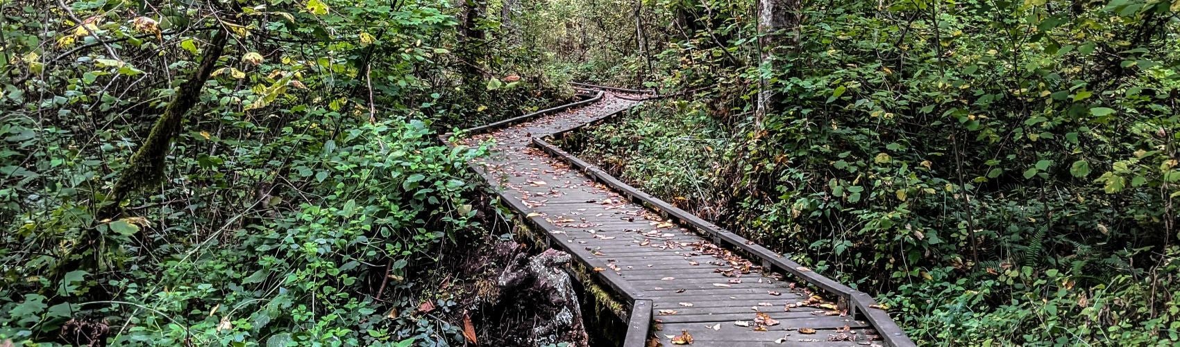
Spring Trail Running In and Around Portland: The Best Routes to Reignite Your Stride
Quick answer: The best spring trail runs near Portland are Wildwood Trail in Forest Park for long, rolling miles; Tryon Creek State Natural Area for soft, beginner-friendly loops; Powell Butte for hill work and Mount Hood views; and Milo McIver State Park and Lacamas Park for quieter, scenic miles just outside the city. Wear grippy trail shoes and pack a light rain shell, since spring weather changes fast.
As the days grow longer and winter fades, spring in Portland brings ideal trail running conditions: cool temperatures, fresh air, and green forests coming back to life. Whether you are training for a race, building endurance, or just escaping the city, Portland's trail network has something for every runner, from smooth, mossy forest paths to steep climbs with big views.
New to trail running? Tryon Creek's gentle loops and Wildwood Trail's forgiving, rolling terrain are great places to start. Craving elevation? Powell Butte and the Marquam Trail up to Council Crest deliver real climbs. And for an adventurous long run, Eagle Creek in the Columbia River Gorge offers waterfalls and rocky singletrack (check current trail conditions and closures before you go).
1. Wildwood Trail, Forest Park
- Difficulty: Moderate
- Length: Up to 30.2 miles point-to-point, with many shorter loop options
- Elevation: Gentle, rolling terrain
- Highlights: One of the longest forested urban trails in the U.S., rolling singletrack, lush scenery year-round
- Access: Multiple trailheads, including Lower Macleay Park, Pittock Mansion, and Germantown Road (Forest Park maps)
Wildwood Trail is Portland's premier trail running destination: more than 30 miles of continuous, well-maintained singletrack through one of the largest urban forests in the country. It is marked every quarter mile, which makes it easy to track pace and distance. The gentle profile suits beginners, while experienced runners can stretch out long sections or connect to steeper side trails.
For a classic Portland run, start at Lower Macleay and climb toward Pittock Mansion for city views, then continue deeper into the forest. In spring, look for blooming trilliums along the way.

2. Tryon Creek State Natural Area
- Difficulty: Easy to moderate
- Length: Up to about 8 miles of trail with many loop options
- Elevation: Minimal to moderate
- Highlights: Soft, well-kept trails, lush forest, beginner-friendly loops
- Address: 11321 SW Terwilliger Blvd, Portland, OR 97219 (visitor info)
Tryon Creek is one of the best places near Portland to ease into trail running or log a gentle recovery run. The Outer Loop covers roughly 5 miles of scenic terrain with slight inclines, while shorter rolling circuits like the Red Fox and North Horse loops wind through tall firs and ferns. Interconnecting trails let you build any distance you like, and shaded creekside sections stay cool on warm spring days.

3. Powell Butte Nature Park
- Difficulty: Moderate
- Length: Several miles of interconnected trails
- Elevation: Roughly 600 to 700 feet to the summit
- Highlights: Summit views of Mount Hood, open meadows, forested switchbacks
- Address: 16160 SE Powell Blvd, Portland, OR 97236 (Friends of Powell Butte)
This extinct cinder cone in Southeast Portland mixes forest switchbacks with open, wildflower-filled meadows. The Mountain View Trail to the summit loop climbs gradually to views of Mount Hood, Mount St. Helens, and on clear days Mount Jefferson. Want more climbing? Link trails like Pipeline Road and Summit Lane for harder ascents, or connect to longer routes for extended endurance days.
4. Milo McIver State Park
- Difficulty: Easy to moderate
- Length: Miles of interconnected trails
- Elevation: Moderate rolling hills
- Highlights: Riverside running along the Clackamas, forest and meadow mix
- Address: 24101 S Entrance Rd, Estacada, OR 97023 (Riverbend Loop guide)
Milo McIver is a quieter option near Estacada. The Riverbend Loop follows the Clackamas River on a smooth, runnable surface, while other loops add moderate climbing through mossy forest and grassland, with occasional Mount Hood views. Soft dirt and rolling hills make it a good spot for speed work, endurance miles, or an easy recovery day.

5. Lacamas Park, Camas, Washington
- Difficulty: Easy to moderate
- Length: Several miles of loop and out-and-back options
- Elevation: Minimal to moderate
- Highlights: Lakeside trails, waterfalls, wildflowers
- Address: 3344 NE Everett St, Camas, WA 98607 (park info)
Just across the river, Lacamas Park mixes wide gravel paths with singletrack. A loop around Round Lake along Lacamas Creek makes a shady, scenic run of a few miles, and the Lacamas Heritage Trail adds a gentle out-and-back extension. In spring the waterfalls run strong and trillium and camas lilies bloom along the trails.
How to Pick Your Spring Route
- Beginner or recovery day: Tryon Creek or Lacamas Park
- Long endurance run: Wildwood Trail
- Hill training: Powell Butte or Marquam Trail to Council Crest
- Quiet scenic miles: Milo McIver
- Adventure long run: Eagle Creek in the Gorge

Be Ready for the Spring Wildcard
Spring weather in the Pacific Northwest changes fast: misty mornings, muddy corners, then surprise sunshine. Wear trail shoes with real lugs, carry a packable rain shell, choose wool socks that stay comfortable when wet, and bring a small first aid kit on longer runs. Most of all, stay curious and enjoy whatever the trail throws at you.
Gear Up at Next Adventure
Before you hit the trail, stop by our Grand Avenue store in Portland's Central Eastside for trail running shoes, breathable layers, hydration packs, and the rest of the essentials. Our staff run these trails too, and we are happy to help you dial in your gear and point you toward local favorites.
Shop trail running gear
- Rossignol Venosk Trail Running Shoe (Men's) Grippy, versatile trail shoe
- Rossignol Venosk Trail Running Shoe (Women's) Grippy, versatile trail shoe
- Rossignol Vercors Trail Running Shoe Built for rougher terrain
- Topo Pursuit 3 Roomy toe box, cushioned ride
- Smartwool Run Zero Cushion Socks Light wool for warm runs
- Smartwool Women's Run Targeted Cushion Socks Wool comfort in wet spring mud
- Patagonia Torrentshell 3L Jacket (Women's) Packable spring rain shell
- Surviveware Small Premium First Aid Kit Compact kit for long runs
Spring Trail Running in Portland FAQ
What is the best trail run in Portland for beginners?
Tryon Creek State Natural Area is a great first trail run. Its trails are soft, well maintained, and mostly gentle, and the many interconnecting loops let you choose a distance that fits your fitness.
How long is the Wildwood Trail in Forest Park?
Wildwood Trail runs about 30.2 miles point-to-point and is marked every quarter mile. Most runners pick a section, such as Lower Macleay to Pittock Mansion, rather than running the whole thing.
Where can I do hill training on trails near Portland?
Powell Butte Nature Park climbs roughly 600 to 700 feet to summit views of Mount Hood, and the Marquam Trail to Council Crest offers a steady, steep climb close to downtown.
What should I wear for spring trail running in Portland?
Wear trail shoes with good traction, wool or synthetic socks, breathable layers, and carry a light rain shell. Spring conditions can swing from mist to mud to sunshine on a single run.

Mastering the Art of Kayak Reentry: A Guide for Sit-On-Top Enthusiasts
Quick answer: To re-enter a narrow sit-on-top kayak, kick to the far side, grab the edge, and pull the boat upright, ...
Read More
Best Shoes for Kayaking: An Expert Review
Quick take: The best kayak shoe depends on how you paddle. The Astral Loyak is a light, packable, grippy all-arounder...
Read More
Brownlee Crappie Shootout Recap: Kayak Fishing Brownlee Reservoir
Quick take: The ninth annual Brownlee Crappie Shootout on Brownlee Reservoir near Richland, Oregon, was a great day o...
Read More