Trip Report: Catherine Creek Day Use Area and Coyote Wall
When: 10/04/2017
Location: Catherine Creek Day Use Area/ Coyote Wall
Conditions: Sunny and warm with a bit of wind. No slippery rocks from previous days. Absolutely gorgeous.
Duration: 3 hours (30 minutes warming up on the Catherine Creek Trail and 2 and a half hours exploring Coyote Wall).
Difficulty: Moderate
Kid Friendly: Yes
Pet Friendly: Yes
Useful links:
Coyote Wall Info: www.oregonhikers.org
Catherine Creek Info: www.oregonhikers.org
 The Full Report:
I had been looking to get back into hiking during the winter season (I had mainly been camping and backpacking during the summer) and thought that these moderate hikes along Coyote Wall and Catherine Creek would be a perfect introduction before the weather took a turn for the worst. So, my friend Zach and I set out on our journey bright and early at 9 am from Portland to the Washington side of the Gorge.
Along the way, as most folks do, we found ourselves right at home at the Marine Drive exit truck stop gearing up with nourishment and some much-needed caffeine for the trek ahead. After reaching cascade locks, crossing the rickety, but oh so lovable Bridge of the Gods and passing through White Salmon we arrived at the Catherine Creek Trailhead and Coyote Wall trail system.
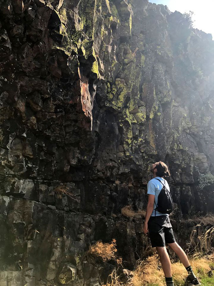
Catherine Creek is a short loop but offers picturesque views of the Columbia River while hikers can walk on a completely paved path that is kid and pet-friendly. As a precursor to the higher elevation hike, Coyote Wall, there are exposed valleys of columnar basalt visible alongside the Catherine Creek Trail Loop and smaller hills that are great for photo ops. Catherine Creek was a respectable hike, but after a quick cliff bar and drink of water, Zach and I were enthusiastic to gain a bit of elevation and hike along the large bluffs of Coyote Wall.
 At the Coyote Wall trailhead, the main path forked in two directions, left and right. We chose the left out of sheer randomness but were not disappointed with what would come next. The beginning of the hike starts with views of golden fields of dry grasses and leads into a few sparse tree stands surrounded by basalt paths. After about 10 minutes of meandering up the trail and a couple failed attempts at handstand selfies, we had already gained significant elevation and could peer over the nearby cliffs slightly off trail. Trekking up to this point wasn't too treacherous, but there were loose rocks along the path, so hiking boots with ankle support and a level head were necessary to stay safe.
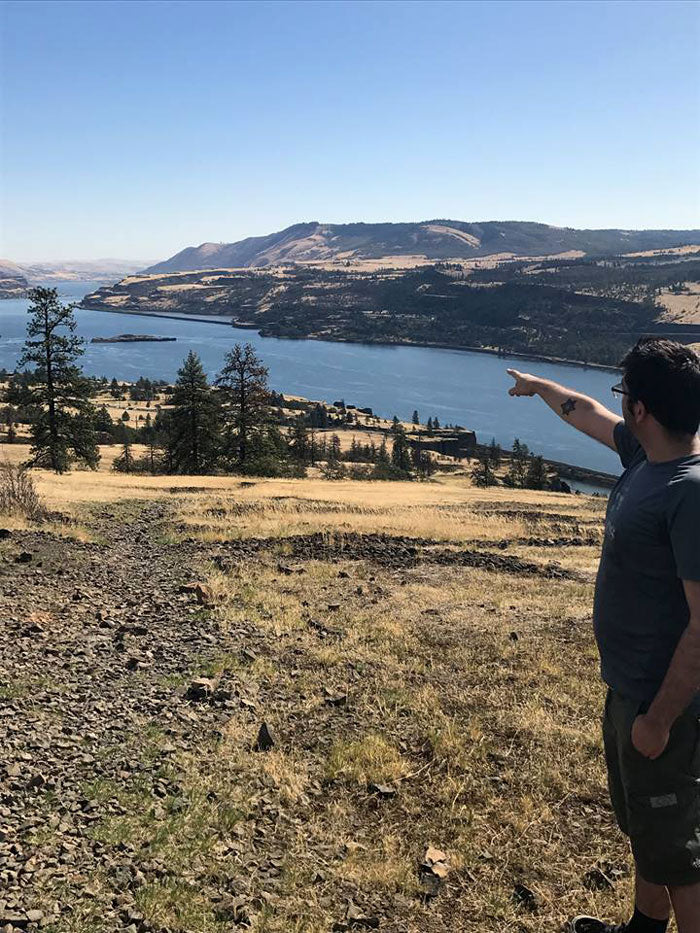
At the first set of cliffs, we took off our day packs and soaked in the unending skyline before us. I had read before that Coyote Wall was an excellent place to bird watch and that Eagles were among the prime suspects for viewing during Winter. Although we didn't see eagles, there were Red-tailed Hawks gliding along the ridge without a care in the world.
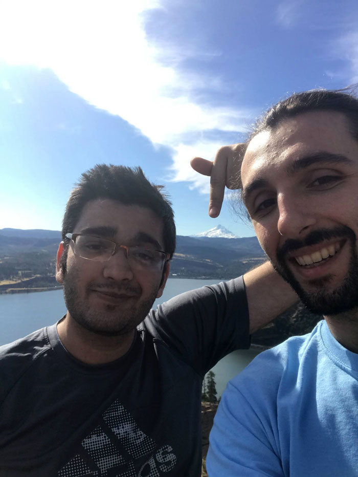
After taking a quick break there, we looked to head towards even higher ground and more spectacular views. We scrambled up loose rocks for another 40 minutes along the trail to reach the top of a nearby valley alongside the bluffs. Again, we took solace in the views before us and were astonished by the exposed landscape. At this elevation, we could see Mount Hood and snapped an awesome perspective shot. But, all good things must come to an end, and reality was beckoning in the form of chores at home and much-needed study time in preparation for college midterms, so we headed back down still reeling from the grandeur of nature.
 Tired out and content, we descended along the dried-out riverbeds lined with glossy tile-like basalt hexagons and found ourselves once again at the parking lot off of Courtney Road. Of course, fist bumps were in order and we hurriedly sought out the shelter of our air-conditioned car for the ride back. The drive back was a reflective one as we aren't always able to get outside to hike as Portlanders, but were oh so grateful for the opportunity.
 The Full Report:
I had been looking to get back into hiking during the winter season (I had mainly been camping and backpacking during the summer) and thought that these moderate hikes along Coyote Wall and Catherine Creek would be a perfect introduction before the weather took a turn for the worst. So, my friend Zach and I set out on our journey bright and early at 9 am from Portland to the Washington side of the Gorge.
Along the way, as most folks do, we found ourselves right at home at the Marine Drive exit truck stop gearing up with nourishment and some much-needed caffeine for the trek ahead. After reaching cascade locks, crossing the rickety, but oh so lovable Bridge of the Gods and passing through White Salmon we arrived at the Catherine Creek Trailhead and Coyote Wall trail system.
Catherine Creek is a short loop but offers picturesque views of the Columbia River while hikers can walk on a completely paved path that is kid and pet-friendly. As a precursor to the higher elevation hike, Coyote Wall, there are exposed valleys of columnar basalt visible alongside the Catherine Creek Trail Loop and smaller hills that are great for photo ops. Catherine Creek was a respectable hike, but after a quick cliff bar and drink of water, Zach and I were enthusiastic to gain a bit of elevation and hike along the large bluffs of Coyote Wall.
 At the Coyote Wall trailhead, the main path forked in two directions, left and right. We chose the left out of sheer randomness but were not disappointed with what would come next. The beginning of the hike starts with views of golden fields of dry grasses and leads into a few sparse tree stands surrounded by basalt paths. After about 10 minutes of meandering up the trail and a couple failed attempts at handstand selfies, we had already gained significant elevation and could peer over the nearby cliffs slightly off trail. Trekking up to this point wasn't too treacherous, but there were loose rocks along the path, so hiking boots with ankle support and a level head were necessary to stay safe.
At the first set of cliffs, we took off our day packs and soaked in the unending skyline before us. I had read before that Coyote Wall was an excellent place to bird watch and that Eagles were among the prime suspects for viewing during Winter. Although we didn't see eagles, there were Red-tailed Hawks gliding along the ridge without a care in the world.
After taking a quick break there, we looked to head towards even higher ground and more spectacular views. We scrambled up loose rocks for another 40 minutes along the trail to reach the top of a nearby valley alongside the bluffs. Again, we took solace in the views before us and were astonished by the exposed landscape. At this elevation, we could see Mount Hood and snapped an awesome perspective shot. But, all good things must come to an end, and reality was beckoning in the form of chores at home and much-needed study time in preparation for college midterms, so we headed back down still reeling from the grandeur of nature.
 Tired out and content, we descended along the dried-out riverbeds lined with glossy tile-like basalt hexagons and found ourselves once again at the parking lot off of Courtney Road. Of course, fist bumps were in order and we hurriedly sought out the shelter of our air-conditioned car for the ride back. The drive back was a reflective one as we aren't always able to get outside to hike as Portlanders, but were oh so grateful for the opportunity.


