Trip Report: Hardy Ridge Trail (Equestrian Trailhead) Washougal, WA
When: 01/01/2018
Location: Hardy Ridge Trail
Conditions: Windy and cold. Many sections of trail covered in hard pack and icy snow. Clear conditions.
Duration: 8.1-9.1 miles (depending on how far up you explore the summit).
Difficulty: Moderate
Kid Friendly: No
Pet Friendly: Possibly depending on your pets fitness.
Usefull links: www.oregonhikers.org
 The Full Report:
This hike was the first of the New Year, and as always, I was ready and raring to go (especially since parking for hiking spots in Beacon Rock natural forest were free on New Years!) My Washington hike exploration had lead me yet again to another, slightly longer, but still beautiful hike in Washougal. This time around I was tackling Hardy Ridge, an 8.1-mile loop with spectacular views of the rugged Washougal mountain range. So, I slumped over from my post-holiday food coma and set out at 10am from Portland with multiple layers, snacks, and extra holiday pounds to shed. The drive from my home in Clackamas is about an hour to reach Hardy Ridge, and despite cold temperatures and Washougal's elevation, highways leading to the trailhead are usually clear (this was the case when I hiked).
One of the great things about this trail is that it is very close to Beacon Rock and accessible via a gravel road nearby the Beacon Rock ranger station, so getting there isn't too treacherous or confusing. This spot and most hiking spots in Beacon Rock State Park require a Discover pass ($10 for a day, $30 annual). It’s important to note that this spot didn't have a kiosk to buy a pass, but one can be bought in the Beacon Rock Trailhead parking lot.
 This day was particularly windy, so layering up was important to fight off the cold temperatures. I layered as usual with a wool base layer, wool pullover, down puffy, and rain layer, along with thermal leggings, hiking pants, and wool socks (they were worth it at the summit).
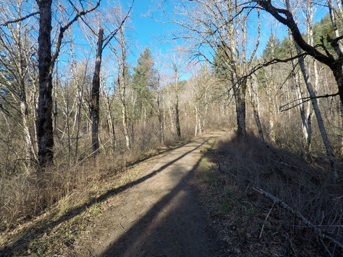
I set off from the Equestrian Trailhead parking lot (this trailhead runs into Hardy Ridge) and hiked up a wide horse trail for a mile until reaching the first set of signs that marked the West Hardy Ridge Trail at a four-way intersection. While you don't turn onto the trail at this point, it is the trail you head down after your summit of Hardy Ridge. After taking a brief rest to snack and drink water, I continued about a half mile longer to another four-way intersection with an option to take a trail labeled "East Hardy Trail."
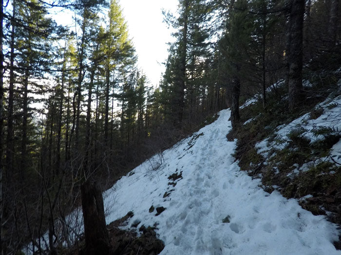
 Each of these intersections were well marked and had a "you are here" type diagram to chart your progress along the trail. The East Hardy Ridge trail starts to look a bit less like an Equestrian trail as you continue on but still has a wide birth. After a bit more walking, you will reach a sign marked "foot traffic only." It is a smaller, well-traveled path that, at that time, was covered with hard pack snow and ice. I luckily had brought my Korker's traction devices to help from slipping too much on the winding switchbacks. While the next section leading to the summit isn't extremely steep and there are previous hiker foot depressions in the snow to use, snowy trails make it difficult to always keep your footing, so having extra traction made the ascent more comfortable.
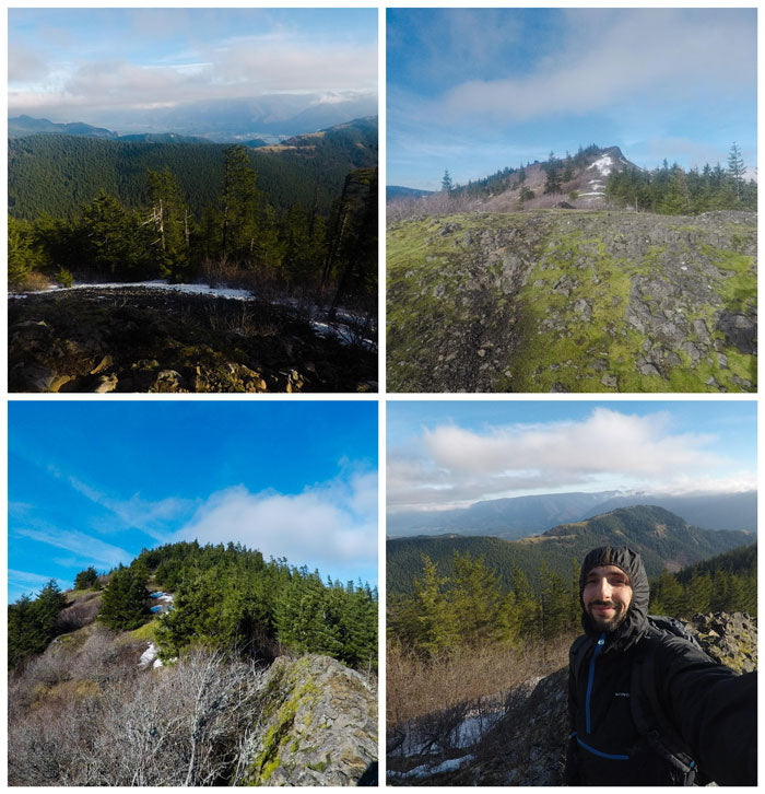
After traveling through a dense, green tunnel of canopy for a couple miles, I reached the first "sub-summit." It was breathtaking and offered 360-degree views of Beacon Rock natural forest. The air was fresh and crisp, and the Columbia River and Hamilton Mountain were in full display as I climbed a small rock feature to get above the tree line. From this point, you can head down the West Hardy Ridge trail (there is a sign indicating which direction to take), or continue on and explore more of the summit further up. I decided to do the latter and see if there were any higher points and views. As I was trudging through the patches of snow along the summit trail, I saw a black dot moving in the distance and realized it was another hiker walking along a higher point on the trail. I steamed ahead and met them as they were coming down. They wished me well as I came up and suggested I eat lunch up there. I happily obliged.
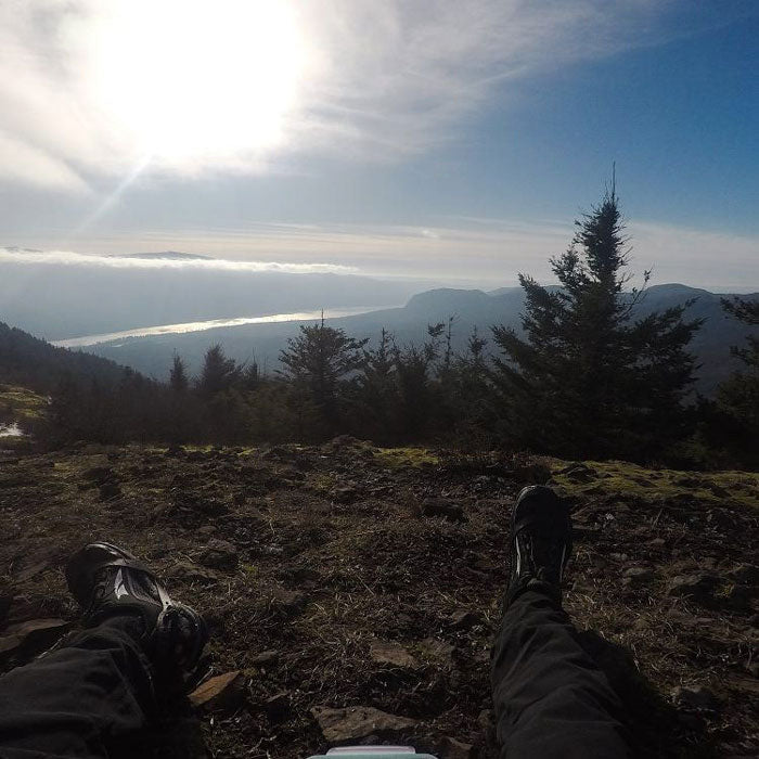
 This was probably one of the most awe-inspiring lunch spots I've ever wolfed down food at in my life. That being said, due to the exposure from winds and reflection of the sun on the snow along the trail (polarized sunglasses are a great idea for this hike), I could only take about 10 minutes of spectating before I retreated downhill to warm back up and finish the hike. I descended via the West Hardy Ridge trail for what seemed like hours before linking back up to the Equestrian trail from which I started, and walked to the parking lot with the first hike of the New Year under my belt.
 The Full Report:
This hike was the first of the New Year, and as always, I was ready and raring to go (especially since parking for hiking spots in Beacon Rock natural forest were free on New Years!) My Washington hike exploration had lead me yet again to another, slightly longer, but still beautiful hike in Washougal. This time around I was tackling Hardy Ridge, an 8.1-mile loop with spectacular views of the rugged Washougal mountain range. So, I slumped over from my post-holiday food coma and set out at 10am from Portland with multiple layers, snacks, and extra holiday pounds to shed. The drive from my home in Clackamas is about an hour to reach Hardy Ridge, and despite cold temperatures and Washougal's elevation, highways leading to the trailhead are usually clear (this was the case when I hiked).
One of the great things about this trail is that it is very close to Beacon Rock and accessible via a gravel road nearby the Beacon Rock ranger station, so getting there isn't too treacherous or confusing. This spot and most hiking spots in Beacon Rock State Park require a Discover pass ($10 for a day, $30 annual). It’s important to note that this spot didn't have a kiosk to buy a pass, but one can be bought in the Beacon Rock Trailhead parking lot.
 This day was particularly windy, so layering up was important to fight off the cold temperatures. I layered as usual with a wool base layer, wool pullover, down puffy, and rain layer, along with thermal leggings, hiking pants, and wool socks (they were worth it at the summit).
I set off from the Equestrian Trailhead parking lot (this trailhead runs into Hardy Ridge) and hiked up a wide horse trail for a mile until reaching the first set of signs that marked the West Hardy Ridge Trail at a four-way intersection. While you don't turn onto the trail at this point, it is the trail you head down after your summit of Hardy Ridge. After taking a brief rest to snack and drink water, I continued about a half mile longer to another four-way intersection with an option to take a trail labeled "East Hardy Trail."
 Each of these intersections were well marked and had a "you are here" type diagram to chart your progress along the trail. The East Hardy Ridge trail starts to look a bit less like an Equestrian trail as you continue on but still has a wide birth. After a bit more walking, you will reach a sign marked "foot traffic only." It is a smaller, well-traveled path that, at that time, was covered with hard pack snow and ice. I luckily had brought my Korker's traction devices to help from slipping too much on the winding switchbacks. While the next section leading to the summit isn't extremely steep and there are previous hiker foot depressions in the snow to use, snowy trails make it difficult to always keep your footing, so having extra traction made the ascent more comfortable.
After traveling through a dense, green tunnel of canopy for a couple miles, I reached the first "sub-summit." It was breathtaking and offered 360-degree views of Beacon Rock natural forest. The air was fresh and crisp, and the Columbia River and Hamilton Mountain were in full display as I climbed a small rock feature to get above the tree line. From this point, you can head down the West Hardy Ridge trail (there is a sign indicating which direction to take), or continue on and explore more of the summit further up. I decided to do the latter and see if there were any higher points and views. As I was trudging through the patches of snow along the summit trail, I saw a black dot moving in the distance and realized it was another hiker walking along a higher point on the trail. I steamed ahead and met them as they were coming down. They wished me well as I came up and suggested I eat lunch up there. I happily obliged.
 This was probably one of the most awe-inspiring lunch spots I've ever wolfed down food at in my life. That being said, due to the exposure from winds and reflection of the sun on the snow along the trail (polarized sunglasses are a great idea for this hike), I could only take about 10 minutes of spectating before I retreated downhill to warm back up and finish the hike. I descended via the West Hardy Ridge trail for what seemed like hours before linking back up to the Equestrian trail from which I started, and walked to the parking lot with the first hike of the New Year under my belt.


